![[{[item.product.name]}]]([{[item.product.photo.url]}] 75w)

")
Mapa Europa polityczna (plakat)
Mapie z podziałem politycznym Europy w skali 1 : 12 000000 towarzyszą symbole wszystkich europejskich państw - flagi oraz herby. Mapa z taką treścią pomoże w opanowaniu nazw krajów i ich stolic, rozmieszczenia na kontynencie względem innych państw i dostępności lub jej braku do morza czy oceanu, zapamiętaniu sąsiedztwa i relacji wielkości powierzchni poszczególnych krajów. Na odwrocie znajduje się kolorowa mapa konturowa. Można ją uzupelniać własnymi podpisami przy pomocy dołączonego do zestawu pisaka suchościeralnego.
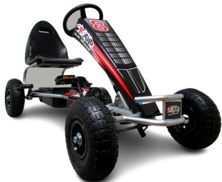
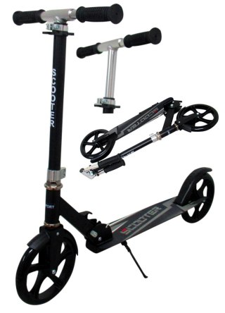
Safety Information
For use under direct adult supervision, Need to use protective measures. Do not use in traffic, Not suitable for children under the specified age. For use under adult supervision, This toy does not offer protection, Includes a toy. Adult supervision recommended
It has the CE mark confirming compliance with the requirements of the European Union directive for this type of device.
CE Declaration of Conformity | Complies with EN-71 - Safety of toys
For children over 3 years of age
It has the CE mark confirming compliance with the requirements of the European Union directive - Compliant with the EN-71 standard - Safety of toys